Changes to Chester charted through the ages as historical map published
A new map charting the changes of Chester over the centuries has been published.
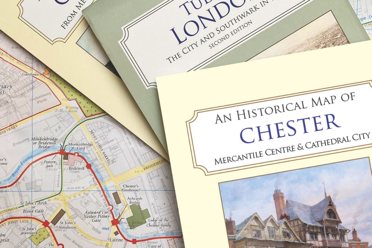
The University of Chester and the Historic Towns Trust have put together An Historical Map of Chester: Mercantile Centre & Cathedral City, a richly detailed map exploring the city’s evolution from a Roman legionary fortress into the thriving cathedral city as it stands today.
It is the result of extensive research by historians Dr Tom Pickles and Professor Katherine Wilson from the University of Chester, in collaboration with their History students, the public, and external stakeholders in the city.
The map visualises how Chester’s geography, trade, religion, and civic life developed over two millennia. Founded as the Roman legionary fortress of Deva and re-founded as an Anglo-Saxon fortified town (burh) in the 900s, Chester was the most important seaport and mercantile city of the North West.
Testament to this are its surviving buildings, especially the unique Rows, stretching along the main four streets of the city – attractive buildings with ground-floor cellars, first-floor halls to the rear, and shops to the front connected by galleries. They originate in the period 1250-1350 and have been repeatedly rebuilt.
The historical map of Chester charts these changes over time and tells the story of the people who shaped the town. Taking as its base a 1911 Ordnance Survey map of the town, the publication shows on a multi-period map how the town developed, and includes lost buildings, cemeteries, earthworks and sites of interest as well as those that remain.
A comprehensive gazetteer on the map’s reverse, complete with many illustrations, explains how Chester grew from a Roman legionary fortress into the modern cathedral city, and introduces its historic buildings and places of interest.
Katherine and Tom said: “We are delighted to bring this historic map of Chester to the public.
“We hope that residents of Chester and the surrounding areas will be able to learn new insights about their important city, its fascinating past and the critical influences on its development, taking them on a journey from 400 to 1900.”
A spokesperson for Historic Towns Trust said: “We are delighted to celebrate the publication of this map, the outcome of a fruitful collaboration with colleagues at the University of Chester.
“Past and present are layered together in modern-day Chester: surviving buildings, ancient street-lines, historic placenames, and commemorations of past events and people are all visible. The map summarises this in a single colourful sheet, backed by text giving the history of notable features and developments. It will help both residents and visitors to grasp the city’s unusually rich history and its impact on the vibrant present.”
To celebrate its publication, an online launch event – open to the public – will take place on Monday, June 16 from 6-7.30pm. The launch event will feature an introduction by Professor Paul Bissell, Pro-Vice Chancellor of Research and Innovation at the University of Chester; short informative talks from Prof Keith Lilley of Queen’s University Belfast, whose mapping of medieval Chester helped initiate the project; Dr Tom Pickles and Prof Katherine Wilson, who will be sharing the map’s research, how it was created and what it reveals of the city’s past; and Giles Darkes, the map's Cartographic Editor.
There will also be a Q&A session at the end of the event, to find out more about the publication, the stories it has uncovered and how it was made.
Spaces are limited and booking is essential. To book a place, visit: https://www.eventbrite.co.uk/e/an-historical-map-of-the-city-of-chester-launch-event-tickets-1374226160439
An Historical Map of Chester: Mercantile Centre & Cathedral City is available to buy now. For more information, and to purchase a copy, visit: https://www.historictownstrust.uk/maps/an-historical-map-of-chester